Stories from the Nakasendo
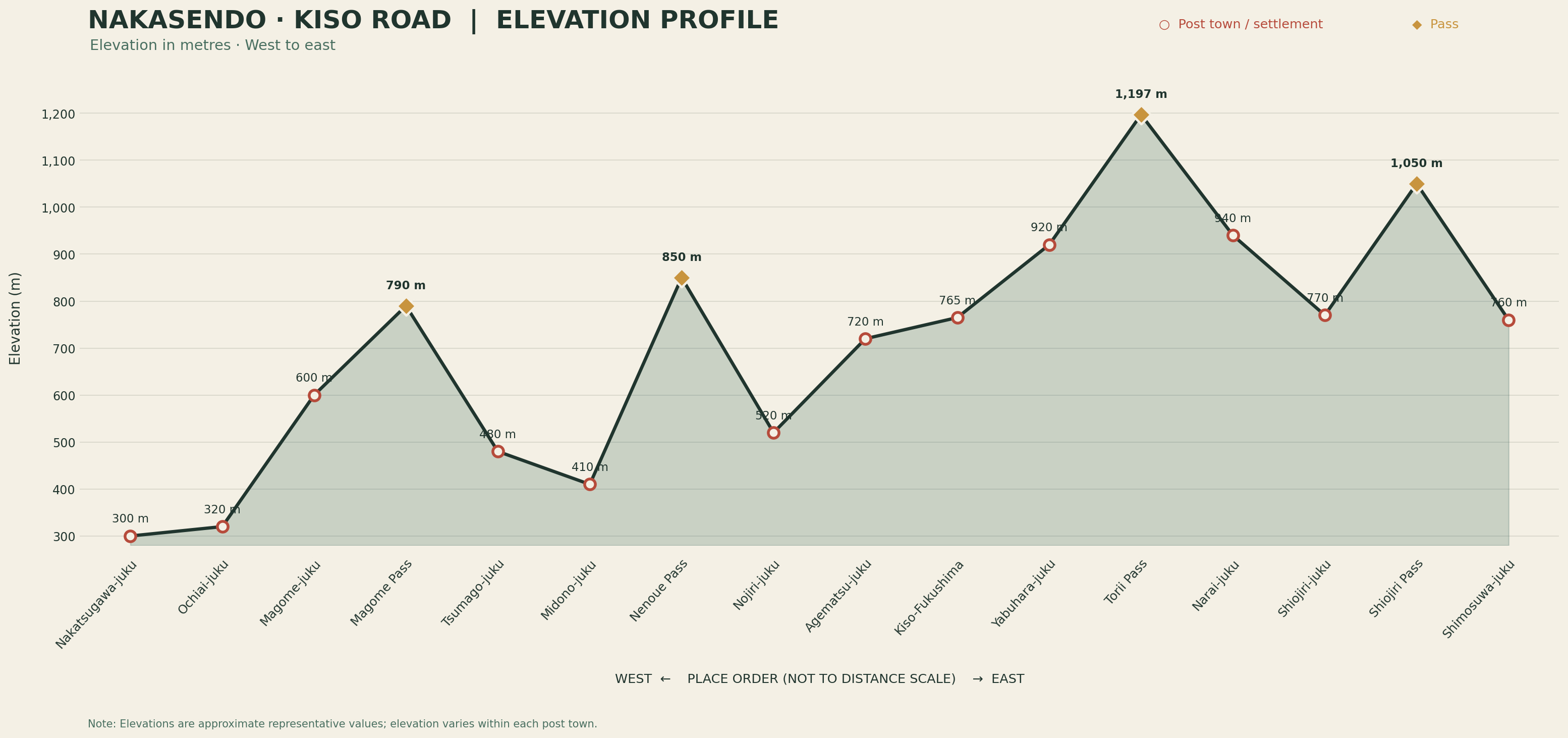
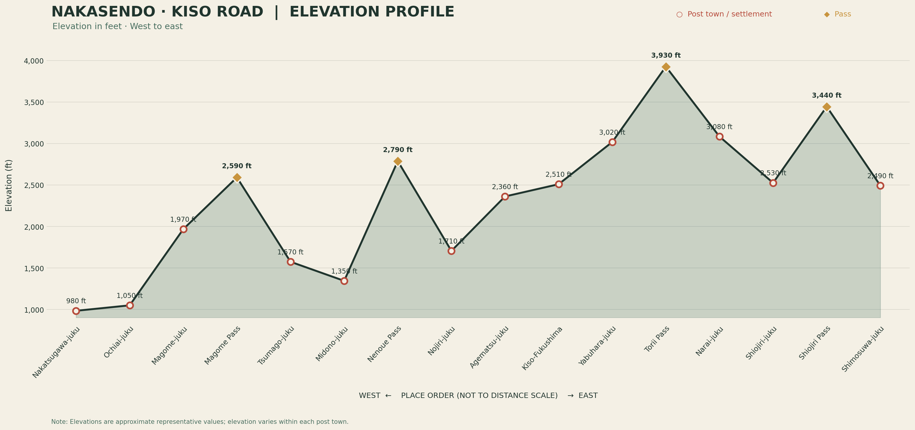
Elevation Profile of the Kisoji
A journey through the mountainous heart of the Nakasendo.
The Kisoji runs entirely through mountainous terrain, with very few flat sections. This elevation profile shows the changes in elevation from Nakatsugawa to Shimosuwa, crossing Magome Pass and Torii Pass along the way.
It offers a clear sense of the varied terrain along this historic section of the Nakasendo.
Written by Ryo Yoshimura — National Licensed Guide Interpreter and Nakasendo Curator.
[Inquire Privately] →